Background
Northumberland County Council operates traffic monitoring across the region, including Holy Island. The island's remote location and environmental protections created unique operational challenges for traditional data collection methods.
Primary Challenges
Geographic Constraints
- 1 hour 20 minute drive each way to monitoring site
- Tide-dependent access restricting visit timing
- Multiple monthly trips required for data downloads
Environmental Requirements
- Area of Outstanding Natural Beauty designation
- Strict visual impact regulations overseen by National Landscape Officer
- Limited options for new infrastructure installation
Resource Implications
- High staff time allocation for routine collection
- Manual data distribution to multiple stakeholders
- No real-time monitoring capabilities
Solution
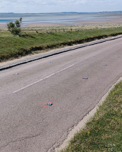
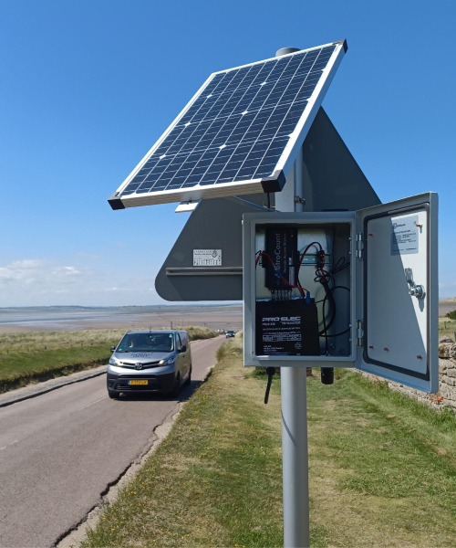
MetroCount's RoadPod® VM system was trialed, featuring patented magnetometers that install within 60 seconds without cutting or grinding the road surface. The solar-powered, off-grid counters provide real-time traffic data including volume, speed, length-based classification and traffic gap analysis. The installation utilised existing infrastructure by mounting the cabinet on a current signpost.
Results
Operational Impact
Manual site visits were eliminated, with automated data transmission providing continuous monitoring. The ATLYST traffic data software platform enabled direct stakeholder access, including support for a Newcastle University research project on tourism's impact on local seal populations.
Performance
The system has operated reliably since the June 2024 installation. Data quality matches previous methods, though bicycle and motorcycle detection remain limited. Winter performance evaluation is ongoing.
Compliance
The discrete installation received National Landscape Officer approval, with road studs barely visible to drivers and minimal visual impact on the protected landscape.
Council personnel reported straightforward platform navigation requiring minimal training. The MetroCount support team provided responsive technical assistance throughout implementation. Travel time elimination was identified as the primary operational benefit.
Scalability
Additional Northumberland locations have been identified for potential implementation, with intentions to expand the data network in future.
Implementation Metrics
- Travel requirements: Eliminated entirely
- Data access: Automated with multi-user capability
- Visual impact: Approved by landscape authorities
- System reliability: Consistent operation since installation
- Training needs: Minimal staff orientation required
The implementation demonstrates suitability for locations requiring discrete monitoring in remote, environmentally sensitive areas with multiple data users and challenging access conditions.
Got a great MetroCount story? Share it with us and let the world know the great work you're doing in your community.