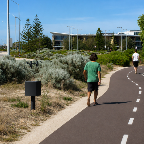
How does the pedestrian counter work?
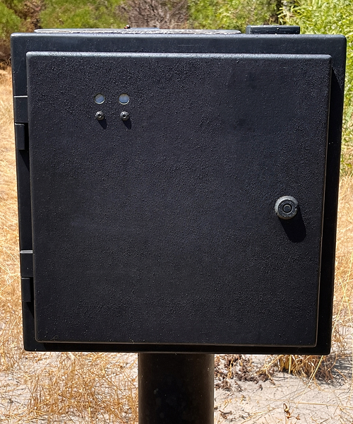
The pedestrian traffic counter uses specialised low-powered thermal infrared sensors to count pedestrians, record direction of travel and help separate cyclists and other users. The counter works by using infrared sensors that project an invisible beam across a path. When a person breaks the beam, the sensor records a count. This counting technology helps collect reliable pedestrian data in a wide range of locations, including shared paths, parks, trails, campuses and urban corridors.
It is designed to be used where pedestrians traverse linearly along a pathway which can include some town centres, tourism destinations, shopping precincts, event spaces, transport hubs and recreational areas where understanding foot traffic is important.
When used with the RidePod® BP bicycle counter, the system helps distinguish pedestrians from cyclists and other shared path users. This is critically important to prevent pedestrians being counted as cyclists and vice versa.
How the data is retrieved
The MetroCount Pedestrian Counter stores count data locally and can be retrieved on-site, with the option to add remote data delivery to your service. By upgrading the Pedestrian Counter with our remote data service, Remote Access Link, pedestrian data can be delivered straight to you via any computer that is running our free MTE® Traffic Data Software. For advanced reporting on your data, MetroCount offers a traffic data subscription service, ATLYST®. View your data through this user-friendly software for data analysis, helping users identify trends such as peak times, daily movement patterns and seasonal changes with clarity.
By analysing count data in ATLYST®, teams can better understand how pedestrians use a location over time and turn raw counting data into clear reports for planning, engineering and policy decisions.
This makes it easier to share findings with internal teams, stakeholders and decision-makers. Clear reports can help explain why an upgrade is needed, where investment should be prioritised and how public spaces are being used by the community.
Accurate People Counting for Public Spaces
A pedestrian counter provides a reliable way to understand how people move through public spaces. Instead of relying on visual observations, manual counting or assumptions, the counter records movement over time and provides objective data that can be reviewed and analysed. This makes it useful for both short-term studies and long-term monitoring projects.
Inform Future Network Planning and Investment
Collecting this type of data helps government organisations support planning and investment for future network expansions, pedestrian safety measures and active transport improvements.
Waarom zijn voetgangersgegevens belangrijk?
De MetroCount infrarood voetgangersteller is geschikt voor gemeenten, stadsplanners, verkeers- en vervoersdiensten, ingenieurs, park- en recreatieafdelingen, winkelgebieden, evenementenorganisaties, universiteiten, ziekenhuizen, grote campussen en toeristische organisaties.
Inzicht in hoe voetgangers zich verplaatsen over gedeelde paden, parken, wandelroutes, stedelijke corridors en natuurgebieden is essentieel voor het ontwerpen van veiligere en toegankelijkere netwerken. De MetroCount® Voetgangersteller levert nauwkeurige gegevens over aantallen voetgangers, looprichtingen en gebruiksintensiteit.
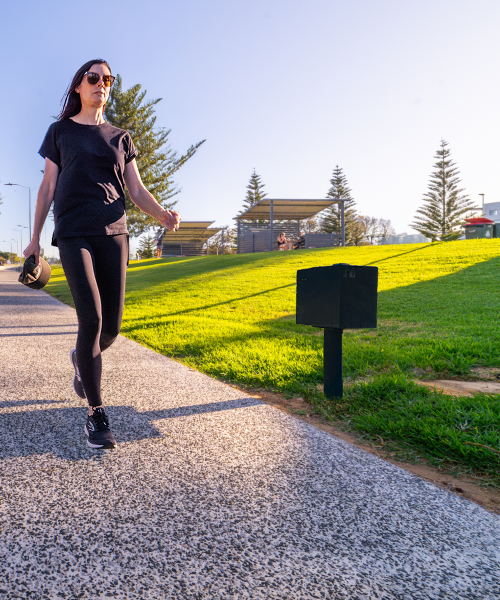
This data can show how many people use a location, when the busiest times occur, which direction pedestrians are travelling and how movement patterns change throughout the day, week or season. For example, a council may use pedestrian count data to understand whether a path is busier during school hours, commuter periods, weekends or holiday seasons. Tourism teams may use the data to measure visitor movement through trails, lookouts or destination precincts.
These insights can guide safer crossings, better footpaths, improved shared paths and more accessible public spaces. They can also support traffic planning, funding applications, event management, tourism strategies, scooter and active transport planning, and long-term infrastructure and facility decisions.
Pedestrian count data is also valuable for before-and-after studies. If a new path, crossing, lighting upgrade or shared path improvement is installed, teams can compare data before and after the project to understand how usage has changed. This gives planners and engineers a clearer picture of whether an investment has improved access, safety or network use.
Instead of relying on assumptions, councils, transport teams, planners and site managers can make decisions based on real evidence for a more people-focused environment.
Waarom is het scheiden van voetgangers-, fiets- en stepgegevens nuttig?
Op gedeelde paden is het belangrijk te begrijpen hoe verschillende gebruikers dezelfde ruimte benutten.
Voetgangers, fietsers en gebruikers van e-steps bewegen vaak met verschillende snelheden en hebben uiteenlopende doeleinden. Door afzonderlijke telgegevens te verzamelen voor deze gebruikersgroepen kunnen verkeersdeskundigen de vraag beter begrijpen, drukke locaties identificeren en veiligheidsverbeteringen plannen.
Deze informatie kan helpen bepalen of een pad behoefte heeft aan verbreding, duidelijkere bewegwijzering, betere markeringen, verbeterde verlichting en extra veiligheidsmaatregelen.
Daarnaast ondersteunt dit actieve mobiliteitsstrategieën door inzicht te geven in het gebruik van wandel- en fietsnetwerken over langere perioden.
Algemeen
TEST Hardware
Additional
Included
- Gebruikershandleiding
- RidePod BP teller
- MTE Software
Required add ons
- Datacommunicatiekabel
- Veldapparatuur voor verkeersonderzoeken
- Aanvullende veldapparatuur voor verkeersmetingen